Sometimes your local real estate board's method of splitting up the neighbourhoods within a city is not detailed enough, or out-dated compared to the direction of the market. A major example would be the Gastown & Chinatown regions of Vancouver. Gastown is lumped in partially to Downtown VW of Vancouver West, and partially to Downtown VW of Vancouver East.
Our system (as of July 2014) now allows you to create your own subareas using a custom-drawn polygon shape on your map.
For example, if you have a custom boundary set for Gastown, Vancouver, each MLS® listing fed in from the RETS system will be compared to the boundaries of Gastown, and if it matches, it will be classified as such. Only if it's not found within the bounds, then it will follow the segmentation based on what the MLS® system has as per the REBGV (Real Estate Board of Greater Vancouver).
To set your custom neighbourhoods & boundaries:
1. Set up the subarea.
In the Brixwork admin section (www.yourdomain.com/admin), hit the "MANAGE CITIES" tab on left bar menu.

Then you can click on the title of any city (i.e. "Vancouver West") to load all the sub-areas of that city.
Here, click on the "Add Subarea" option.

How to Generate a polygon:
1. Go to https://geojson.io/
2. Zoom in to your desired location on the map.
3. Click on the "Draw a polygon" star-shaped button in the toolbar on the right-hand side of the screen.

4. Click on the map to create a starting point of the polygon.
5. Continue clicking on the map to create additional points. You can create a polygon with as many points as you like.
6. Double-click or hit enter to complete the polygon.
7. On the right side of the screen, you can see the JSON code for the polygon you just drew. Locate the coordinates key in the JSON code. This is the array of the polygon's vertices.
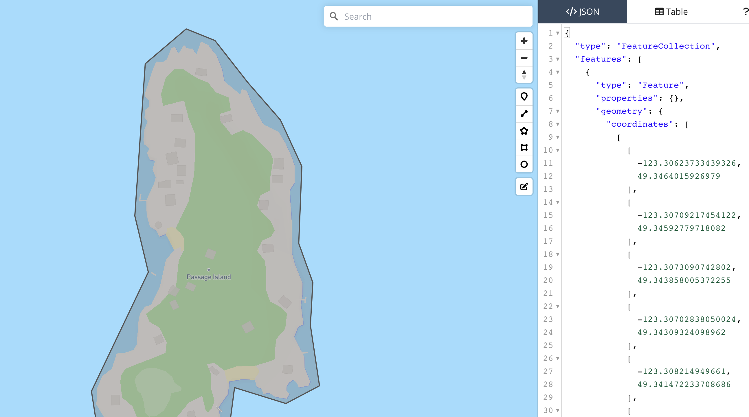
8. Click on the first [ character of the coordinates array to highlight it.
9. Scroll down to the end of the coordinates array and hold down the Shift key.
10. Click on the last ] character of the coordinates array to highlight it. This should highlight the entire coordinates array.
11. Copy the coordinates
12. Paste the coordinates into a text editor
13. Remove all [ and ] brackets and separate coordinates with a line break
14. Reorder coordinates to be latitude first
15. Paste the coordinates into the text block below. Coordinates MUST BE in lat long order

16. Click "Save Area" and you're done !
